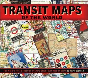
Transit Maps of the World: The World's First Collection of Every Urban Train Map on Earth
Ovenden, Mark
Transit Maps Of The World Is The First And Only Comprehensive Collection Of Historic And Current Maps Of Every Rapid-transit System On Earth. Using Glorious, Colorful Graphics, Mark Ovenden Traces The History Of Mass Transit-including Rare And Historic Maps, Diagrams, And Photographs, Some Available For The First Time Since Their Original Publication. Transit Maps Is The Graphic Designer's New Bible, The Transport Enthusiast's Dream Collection, And A Coffee-table Essential For Everyone Who's Ever Traveled In A City. How To Use This Book / Mike Ashworth -- Forward / Hans Rat -- Introduction: Early Railroads -- Introduction: Urban Rail Transport -- Introduction: Early Railroad Maps -- Introduction: From Maps To Diagrams -- Zone 1: Berlin, Chicago, London, Madrid, Moscow, New York, Paris, Tokyo -- Zone 2: Barcelona, Boston, Budapest, Buenos Aires, Hamburg, Hong Kong, Lisbon, Mexico City, Montreal, Munich, Osaka, San Francisco, Seoul, St. Petersburg, Washington D.c. -- Zone 3: Amsterdam, Athens, Beijing, Bilbao, Brussels, Bucharest, Copenhagen, Delhi, Glasgow, Kiev, Kuala Lumpur, Los Angeles, Lyon, Nagoya, Newcastle, Oslo, Philadelphia, Prague, Rio De Janeiro, Rome, Rotterdam, Sao Paulo, Singapore, Stockholm, Taipei, Toronto, Valencia, Vienna -- Zone 4: Atlanta, Baltimore, Bangkok, Cairo, Guangzhou, Kharkiv, Lille, Marseille, Milan, Naples, Newark, Nizhniy Novgorad, Recife, Santiago, Shanghai, Warsaw -- Zone 5: Cologne & Bonn, Cleveland, Dublin, Franfurt, Hannover, Jacksonville, Liverpool, Manchester, Melbourne, Miami, Nuremburg, Pittsburgh, Porto, Rhine-ruhr, Stuttgart, Sydney, Tunis, Zurich -- Zone 6: Adana-belgrade, Belo Horizonte-calgary, Caracas-daejeon, Dallas-fukuoka, Genoa-houston, Incheon-kobe, Kolkata-manila, Maracaibo-nottingham, Novosibirsk-rennes, Rouen-san Juan, Santo Domingo-tbilisi, Tehran-yokohama. Mark Ovenden ; Edited By Mike Ashworth.
Subways--History, Subways--History--Maps, Local transit--History, Local transit--History--Maps, Railroads--History, Railroads--History--Maps, G1046.P33 O9 2007, 912
| Name in long format: | Transit Maps of the World: The World's First Collection of Every Urban Train Map on Earth |
|---|---|
| ISBN-10: | 0143112651 |
| ISBN-13: | 9780143112655 |
| Book pages: | 144 |
| Book language: | en |
| Edition: | Illustrated |
| Binding: | Paperback |
| Publisher: | Penguin Books |
| Dimensions: | Height: 9.45 Inches, Length: 10.89 Inches, Width: 0.35 Inches |


